Monumental Border Mistakes:
Boundary Monument 127 and the Arizona-Sonora Line
Text and original photography by Carlos Francisco Parra
January 20, 2021
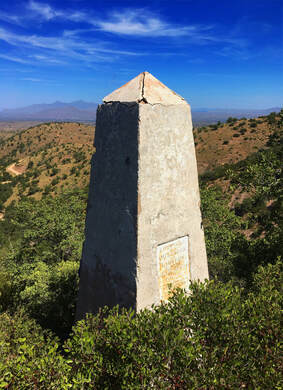
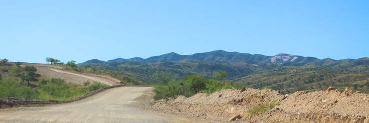
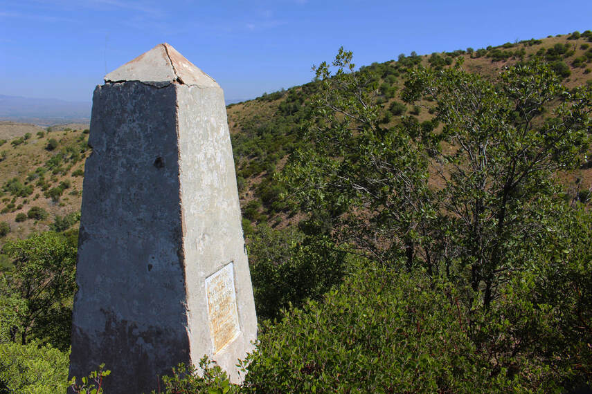
Nestled in the rough mountainous country west of the cities of Nogales, Arizona, and Heroica Nogales, Sonora, Mexico, Boundary Monument 127 is a significant geographic turning point for the U.S.-Mexican border.
|
First surveyed in 1855, what became Boundary Monument 127 is important as the location where the border begins following an angle allowing Mexico to keep a land link between the Baja California Peninsula and the country’s interior. For the U.S., the geographic point marked by Boundary Monument 127 and surrounding monuments 126 and 128 meant it had control of the gold, silver, and copper deposits west of Nogales as well as a southern border for what became the state of Arizona. The stone monument is located along a steep hill covered in dense shrubs with sweeping views of the Santa Cruz River Valley. For nearly 170 years the Arizona-Sonora Boundary Angle monuments marked the border in quiet isolation until late summer 2020 when it became a staging ground for the construction of the divisive border wall system promoted by the U.S. government.
|
As controversial as the U.S. border wall system project has been throughout the region, Boundary Monument 127 is at the center of an even greater controversy – it is 4.41 miles (7.1 km) off from the coordinates agreed upon by the two countries in 1854 for the start of the boundary line between Nogales and the Colorado River.
Quick Summary:
- The Gadsden Purchase Treaty (1853-1854) modified the U.S.-Mexican border into its current form, extending the border into Nogales, Arizona and Nogales, Sonora, Mexico
- First built in 1855 and reconstructed in 1893-1894, Boundary Monument 127 is one of the oldest structures in the area and marks the beginning of the Arizona-Sonora diagonal boundary which allows Mexico to keep land access to Baja California
- Boundary Monument 127, the Arizona-Sonora boundary angle, and the new 2020-2021 U.S. border wall are located on the wrong spot, leading to additional loss of territory for Mexico
Gadsden Purchase Treaty: U.S. Expansion and Mexican Territorial Integrity
|
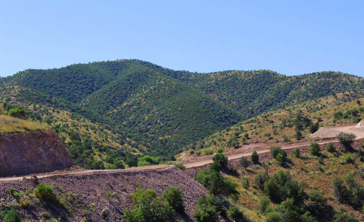
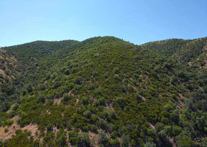
Boundary Monument 127 is located in the Sierra del Pajarito (little bird mountains) west of Nogales at an elevation of 5,239 feet above sea level. It is here that the straight line forming the two countries’ boundary between the U.S. states of Arizona and New Mexico and the Mexican states of Sonora and Chihuahua turns northwest towards the Colorado River and California. The adjoining monuments to the east and northwest – 126 and 128, respectively – mark the border’s continuation from this point. At about 5,470 feet above sea level, Boundary Monument 128 is one of the highest points on the U.S.-Mexican border.
|
The Pajarito Mountains west of Nogales
|
|
As the beginning of the diagonal (or azimuth) boundary between Nogales and the Colorado River near Yuma, Arizona, Boundary Monument 127 is a notable reference point in the state outlines for both Arizona and Sonora. The boundary angle Monument 127 indicates first became important when the U.S.-Mexican border was extended into the Nogales area in the mid-1850s. In fact, the creation of the Arizona-Sonora boundary around Nogales was one of the last major changes to the Mexico-United States border.
|
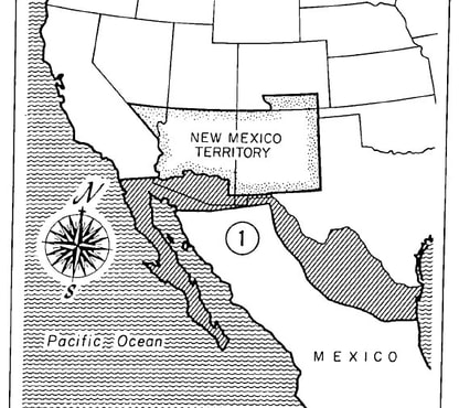
Although Mexico already lost much of western North America to the U.S. after the 1848 Treaty of Guadalupe Hidalgo, many U.S. politicians wanted the U.S. to push its borders further south into Mexico. Investors based in the U.S. South agitated for the construction of a transcontinental railroad linking California with the southern slaveholding states. The border created by the Treaty of Guadalupe Hidalgo did not allow for the easy construction of a railroad through what is now Central Arizona and New Mexico. Easier routes for railroad construction existed in what was still Mexican national territory.
|
In fall 1853 the U.S. aggressively approached the Mexican government with an offer to purchase land for the desired railroad routes. Represented by Ambassador James Gadsden, an ardent slaveholder and former railroad executive, the U.S. attempted to extend the border far south into Mexico, offering to buy the Baja California peninsula and significant portions of the states of Tamaulipas, Nuevo León, Coahuila, Chihuahua, and Sonora. Antonio López de Santa Anna, President of Mexico for the 11th time, needed the money, but negotiated to keep the Mexican border as far north as possible. The Mexican government resisted selling Baja California and pushed to keep a land connection to the peninsula through Sonora, requiring that the border include a boundary angle. Mexican diplomats feared losing Baja California to the U.S. if it did not keep a land link to it.
|
One of the more...ambitious....Gadsden Purchase Treaty proposals (Walker and Bufkin, Historical Atlas of Arizona).
|
|
Failing to convince Mexico to part with most of its northern states, Gadsden signed a secret treaty with the Mexican government on December 30, 1853 accepting the proposal for the revised border at a cost of $15 million. After heated debate, the U.S. Senate ratified a modified version of the treaty on April 25, 1854, reducing the land purchased from Mexico and the U.S. payment to $10 million. [1]
|
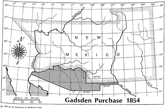
Mexico kept a land link to Baja California through the boundary angle created by the final version of the Gadsden Purchase (Walker and Bufkin, Historical Atlas of Arizona).
|
In what became known as the Gadsden Purchase (or “Sale of La Mesilla” in Mexico), the new border was outlined as follows:
Beginning in the Gulf of Mexico, three leagues from land, opposite the mouth of the Rio Grande, as provided in the 5th article of the treaty of Guadalupe Hidalgo; thence, as defined in the said article, up the middle of that river to the point where the parallel of 31° 47' north latitude crosses the same; thence due west one hundred miles; thence south to the parallel of 31° 20' north latitude; thence along the said parallel of 31° 20' to the 111th meridian of longitude west of Greenwich; thence in a straight line to a point on the Colorado River twenty English miles below the junction of the Gila and Colorado rivers; thence up the middle of the said river Colorado until it intersects the present line between the United States and Mexico.” [2]
Coordinates 31° 20' North and 111° West – marked by what is now Boundary Monument 127 – are the reference point for the Arizona-Sonora boundary angle meant to preserve Mexico’s land link to Baja California.
Putting Monument 127 and the Boundary Angle on the Map
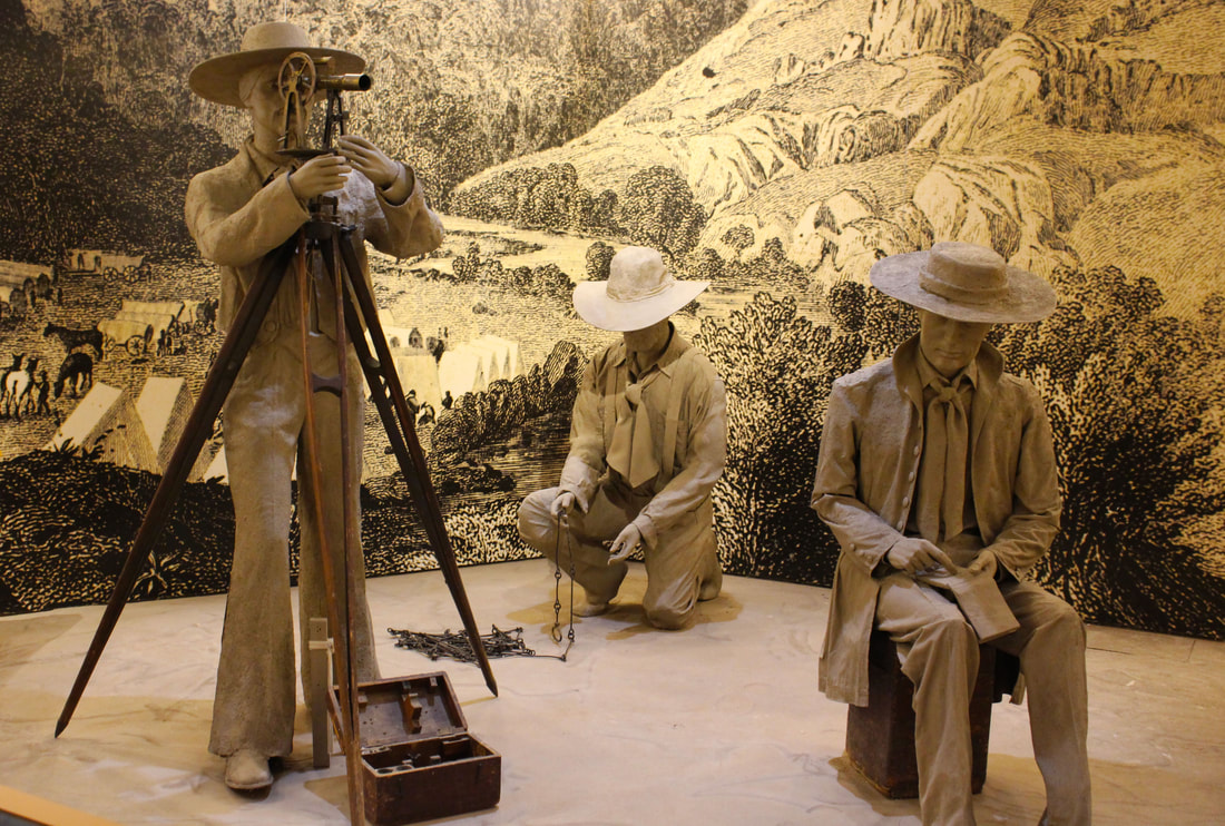
A representation of the chains and other tools used by the U.S.-Mexican boundary surveyors (Chamizal National Memorial, El Paso, Texas)
|
As part of the Gadsden Purchase Treaty, both countries worked together to map their new border. Running behind schedule, the U.S. Boundary Commission led by Major William Emory began its work in El Paso, Texas, on December 4, 1854, and worked its way west from what is now Boundary Monument 1 along the Rio Grande. The U.S. Boundary Commission set up monuments, usually just rock piles, to mark the border. [3]
|
By late spring 1855 Emory and his team of surveyors, astronomers, soldiers, and servants, reached the Nogales area seeking to find the start of the boundary angle at 31° 20' North and 111° West. The U.S. Boundary Commission set up a field observatory in what is now Nogales, Arizona to mark the border through astronomical observations. Emory described what would become one of the busiest U.S.-Mexican border crossings as an “isolated position near the center of the continent.” [4]
Navigating the canyons and slopes of the Pajarito Mountains, the U.S. Boundary Commission found the spot they believed to be 31° 20' North and 111° West along a steep hillside.
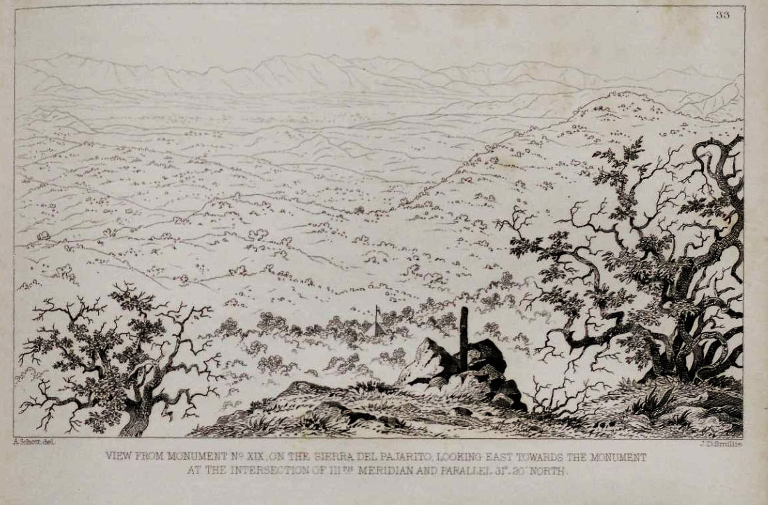
Boundary Monument XIX (later numbered 128) looking east towards the pyramid-like marker which became Boundary Monument 127. [5]
The U.S. Boundary Commission constructed Boundary Monument 127 as a small pyramid built of dressed stone laid without mortar. Emory left an inscription with his name and the date on the stone marker. A large oak tree on the nearby ridge “was found to be in the direction” of the Arizona-Sonora diagonal line and used as the following border monument (today’s Boundary Monument 128). [6]
Despite the importance of the Arizona-Sonora boundary angle for Mexico’s territorial integrity, only the U.S. Boundary Commission marked the location of 31° 20' North and 111° West. The Mexican Boundary Commission was unable to get into the field because of the crisis caused by López de Santa Anna’s secret negotiations selling Mexican national territory becoming public. The Mexican Congress’s ratification of the Gadsden Purchase treaty led to López de Santa Anna’s final overthrow
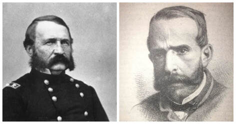
Major William Emory and Capt. Francisco Jiménez [7]
The U.S. Boundary Commission had mapped most of the border from El Paso alone by the time a small team led by Captain Francisco Jiménez arrived in Nogales in mid-June 1855 after Emory’s team marked the boundary angle. Having had a positive working relationship with the U.S. party surveying the other end of the border near Yuma, Captain Jiménez asked Emory for time to calculate the location of the Arizona-Sonora boundary angle. According to Jiménez, Major Emory looked at him and asked if he thought he was capable of practicing such a deception. Perhaps embarrassed, Jiménez accepted the U.S. Boundary Commission’s calculations and corresponding border monument on June 21, 1855. The two boundary commissions then worked quickly throughout the summer to survey the border across the rugged mountains and deserts between Nogales and the Colorado River. [8]
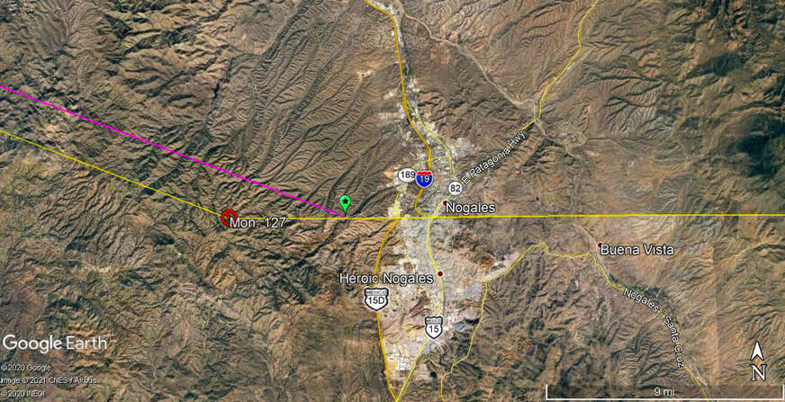
The Arizona-Sonora boundary angle should be located at the spot marked in green
If Captain Jiménez had not been such a gentleman – and had not been delayed waiting for funding, equipment, and soldiers from the Mexican Government – he might have discovered that the U.S. Boundary Commission placed the Arizona-Sonora boundary angle at 31°19'56.40” North and 111° 4'29.97” West, 4.41 miles (7.1 km) too far west of the correct coordinates mandated by the Gadsden Purchase Treaty. Rather than being on the slopes of the Pajarito Mountains, 31° 20' North and 111° West is in an arroyo just west of what is now the Mariposa Port of Entry between Nogales, Arizona, and Sonora.
|
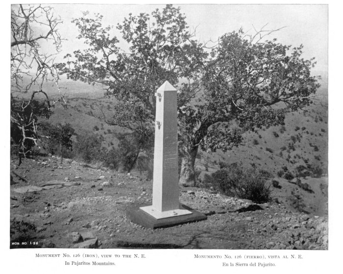
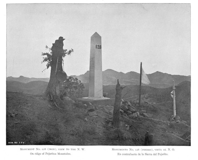
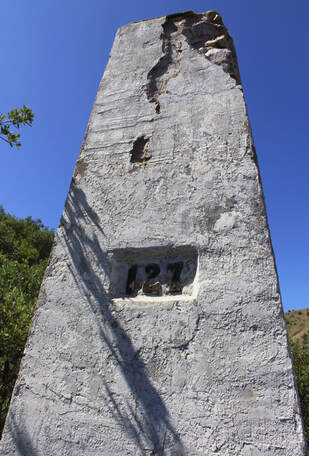
This monumental error was not officially discovered until 40 years later when the U.S. and Mexico resurveyed their border after the region’s population began growing. The 1891-1896 U.S.-Mexican International Boundary Commission rebuilt many of the old border monuments, including the boundary angle monument. Although Emory’s inscription was still legible, the stone monument was “tumbling to pieces.” Between 1893-1894 the monument was repaired and numbered 127 while new prefabricated cast iron monuments (126 and 128) were placed on the nearby ridges to show the border’s turning point. However, the new Commission did not have the power to realign the border. [9]
|
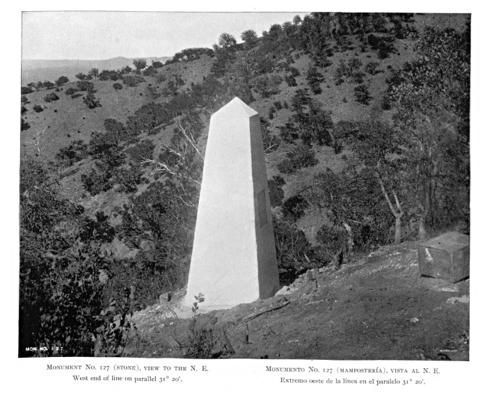
|
Despite losing a sizeable amount of territory due to the surveying error, the Mexican government did not actively pursue the issue [11].
Although it is not clear if Emory maliciously took advantage of Jiménez’s delay, the U.S. was well aware of the mining potential for copper, silver, and gold in the mountains west of Nogales. “The eastern slope of the Sierra del Pajarito (Los Nogales) is especially worthy of exploration with reference to a development of its mineral production,” wrote one U.S. boundary surveyor. [12]
On the Boundary Angle Trail Today
|
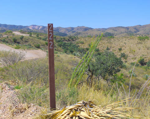
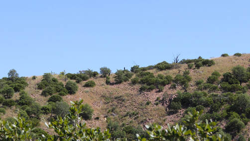
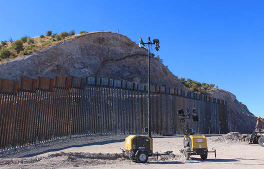
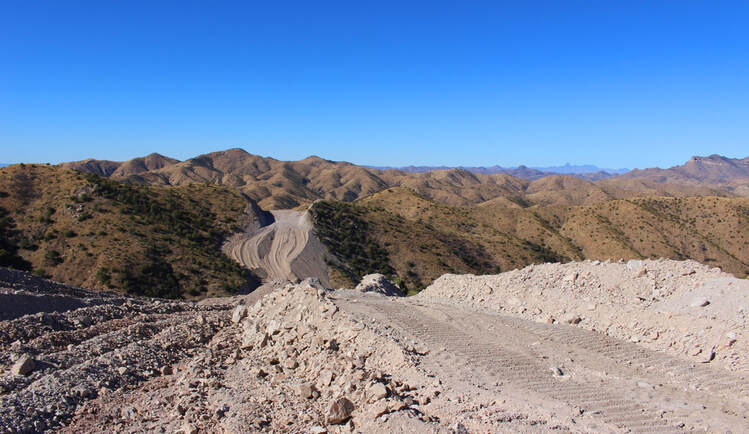
Today, the incorrectly-placed Boundary Monuments 126, 127, and 128 still stand and are accessible via Coronado National Forest Service Road 222, a dirt road which links to Arizona State Highway 289. Recently expanded as part of the U.S. government’s Border Wall System Project, Forest Service Road 222 quickly gains elevation as it climbs the Pajarito Mountains.
|
U.S. Lieutenant Nathaniel Michler’s words from the 1855 survey come to mind:
Clambering up a steep ascent gained the crest of the hills; riding or walking along it as best we could, and passing from hill to hill, each higher as we advanced, we finally reached the point where the monument stands. The hill on the side of which it is erected is low compared to the high peaks in its immediate vicinity; its locality is not easily discovered.” [13]
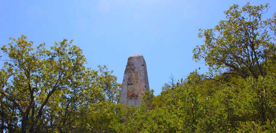
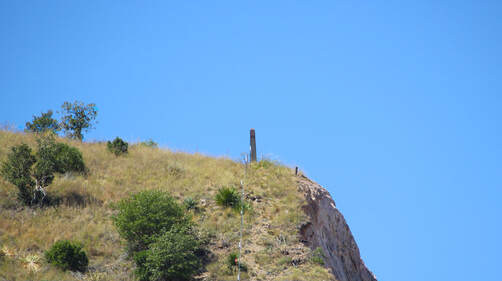
Although obscured along most of the way, the bright white paint of Boundary Monument 127 comes into view from a nearby ridge.
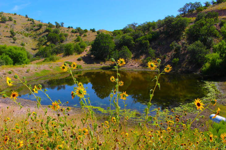
Entering the canyon where the Boundary Angle Monuments are located, we pass a cattle drinking pond. Known as the Monument Tank, the pond is fed during rainstorms by an arroyo (or stream) originating a few yards away in Mexico.
|
The canyon narrows as we walk up an arroyo which soon forks in two up at the base of the mountainside where Boundary Monument 127 is located. Evidence of undocumented migrant traffic is apparent here. Climbing up leads us through a steep narrow trail along thickets of manzanita bush and oak trees.
|
|
After crawling under a barbed wire fence located north of the border, one finally reaches Boundary Monument 127 as the slope continues to its crest.
|
|
Boundary Monument 126 (looking east towards Nogales).
|
Boundary Monument 128 (looking northwest towards the Colorado River).
|
Here we can see the gradual shape of the Arizona-Sonora boundary angle by looking at nearby Boundary Monuments 126 (east) and 128 (northwest).
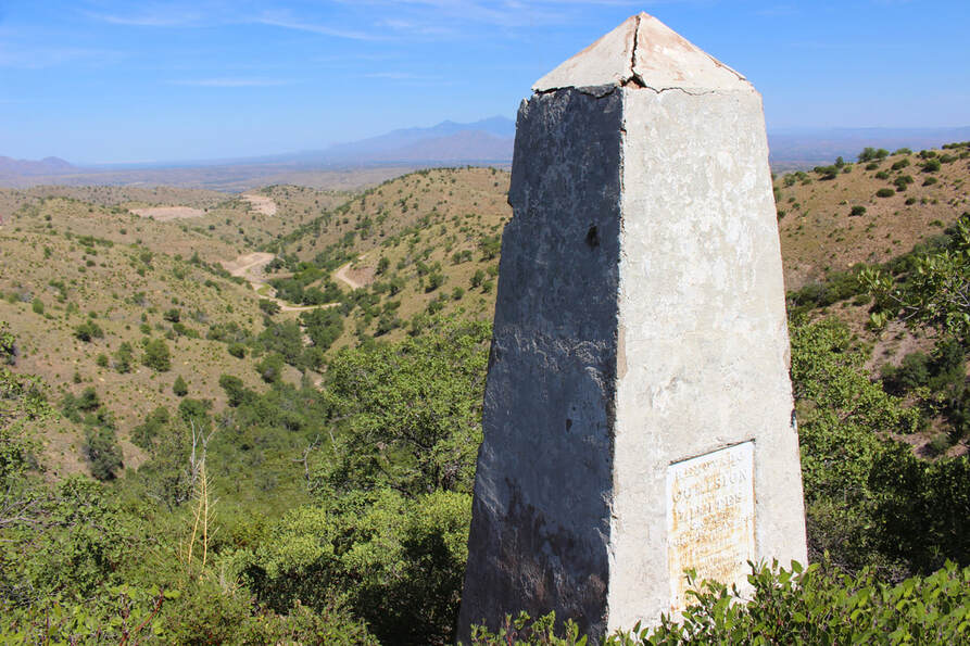
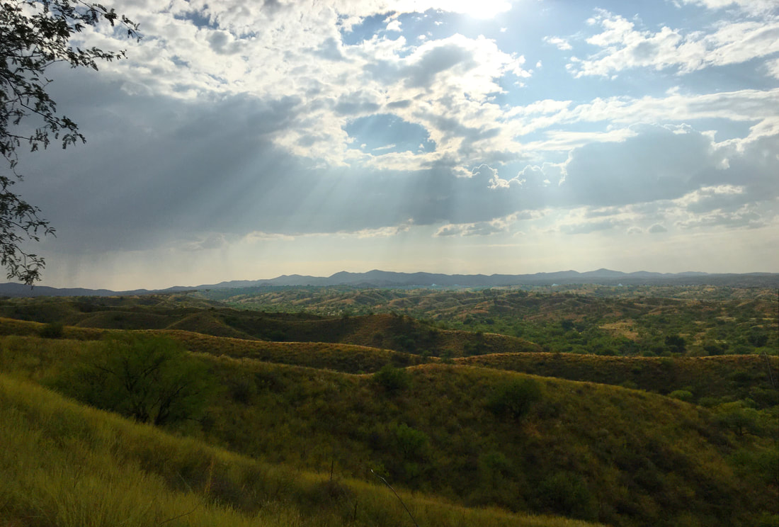
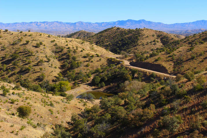
From Boundary Monument 127 we have a canyon-framed view of Southern Arizona….
...which is even better from the higher elevation of Boundary Monument 126. To the southeast in Mexico we can see the Sierra el Pinito (and the distant Sierra de Cananea), the Sierra de San Antonio and the Patagonia Mountains in Arizona – which are really one mountain range but divided by the U.S.-Mexico border. Our panorama continues east to northwest from the border cities of Nogales, the Santa Cruz River Valley and the San Cayetano, Santa Rita, Santa Catalina (near Tucson), Atascosa and Baboquivari Mountains in Arizona.
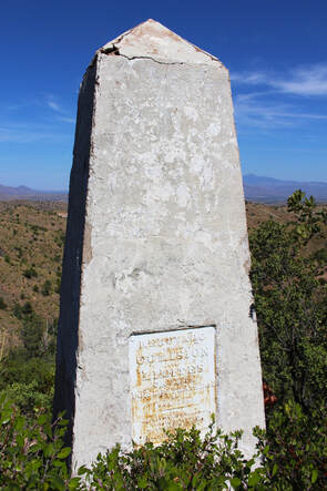
Back at Monument 127, the Mexican side of the marker is well-preserved and its Spanish-language brass inscription is easy to read.
|
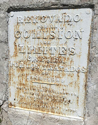
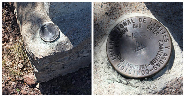
“Renovado por la Comisión de Limites creada por los tratados de 1882-1889 - Destrucción o dislocación de este monumento es un delito punible por México o los Estados Unidos." |
|
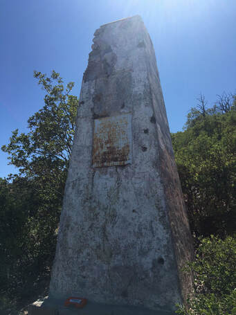
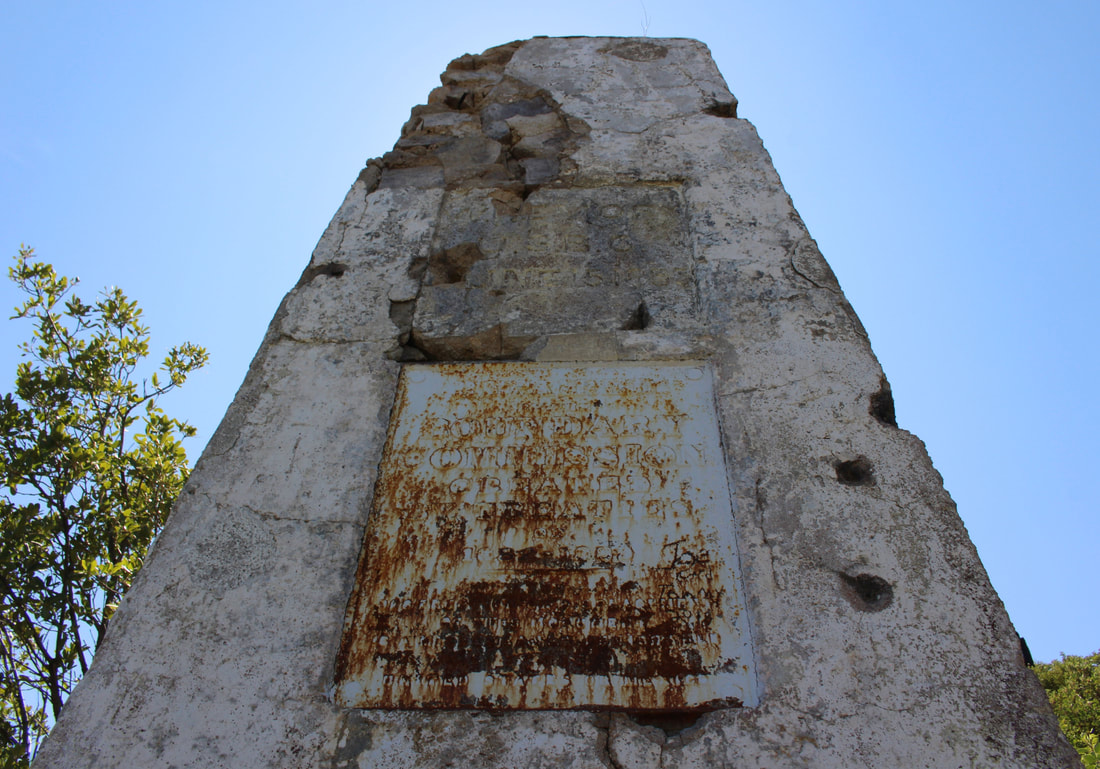
However, the U.S. side shows many years of target practice and graffiti while its brass plate shows 130 years of rusting.
Repaired by the Boundary Commission created by the treaties of 1882-1889 -the destruction or dislocation of this monument is an offense punishable by the United States or Mexico.” Above is the stone inscription from the original 1855 monument which was reused after the monument’s 1893-1894 repair.
|
|
|
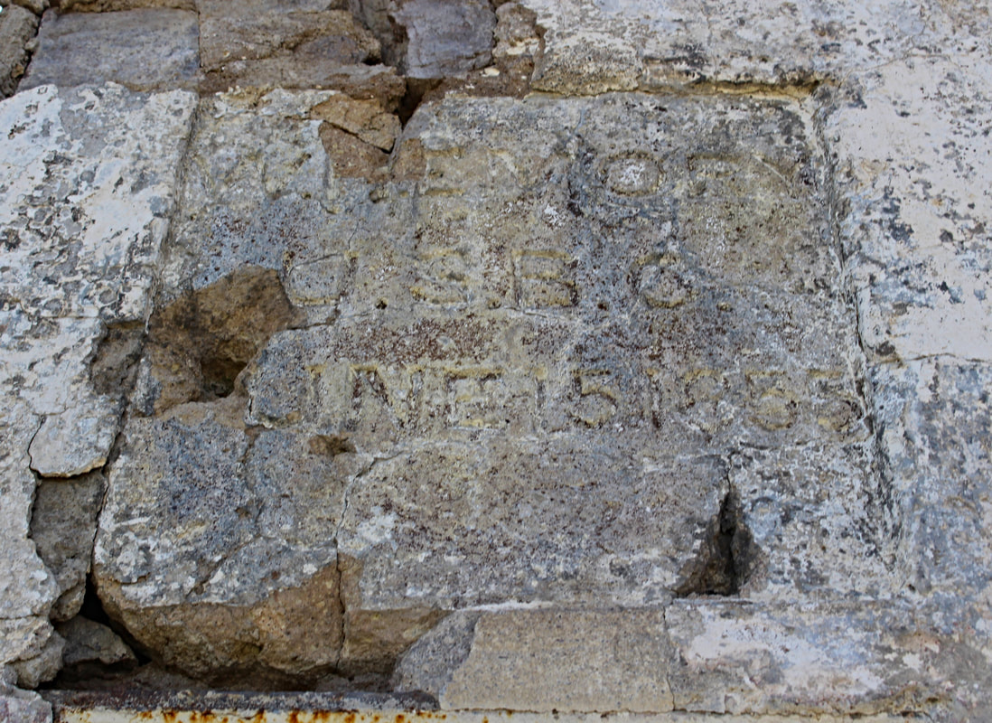
Though difficult to read after 170 years of rains, snows, fires, target practice and neglect, the inscription states:
(W) EMORY This faded inscription is one of the few surviving relics from the original 1840s and 1850s U.S.-Mexican boundary markers and is an incredible reminder of how the border was once only marked by stone monuments often little more than rock piles.
|
|
Monument 127 and the other boundary angle markers are some of the oldest surviving structures in Nogales, Arizona, and Nogales, Sonora, and are critically important for marking the border and shaping the development of Arizona and Northwestern Mexico. However, none of these monuments are on any historical preservation lists and are mostly unknown by area residents. [14]
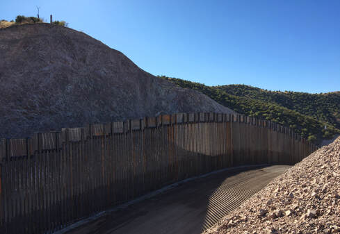
Boundary Monument 127 in September 2020
Losing History with U.S. Border Wall Construction
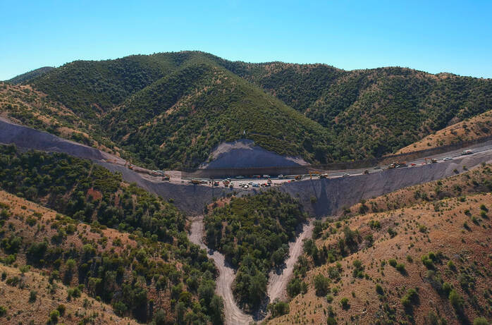
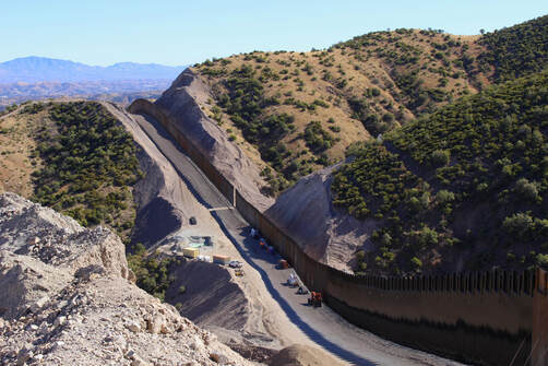
Boundary Monument 127 in November 2020

|
Recently an even greater monumental mistake was made as the U.S. government built its destructive border wall in the area. By October 2020 the Fisher Sand and Gravel Company bulldozed the mountainsides along the boundary angle monuments to install the pre-assembled portions of the border wall system. Our hiking route is no longer possible to retrace now that the 30-foot steel and concrete border wall has separated Boundary Monument 127 from the U.S. The 170-year-old historic monument is now literally on the edge of a man-made cliff and potentially at risk of collapsing from erosion.
|
|
|
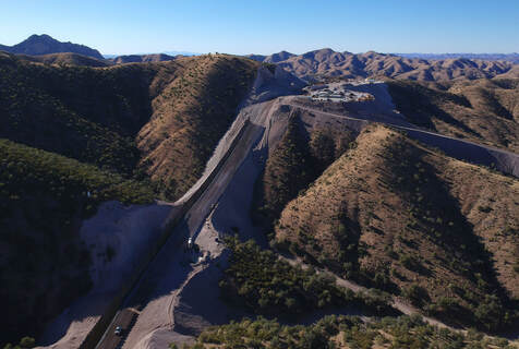
The remote mountains are now a busy industrial construction zone with the ridge next to Boundary Monument 128 completely flattened to make way for a concrete batch plant for the U.S. border wall’s construction. From Boundary Monument 128 a new construction access road is beginning to puncture the impenetrable Pajarito Mountains.
|
|
Boundary Monument 126 just to the east is now also inaccessible from the United States. In addition to being routes for migrants and smugglers, the Pajaritos and other nearby mountain ranges are important migration corridors for wildlife, including deer, javalinas, ocelots, and endangered jaguars. This destructive border wall project is the latest human activity to threaten these species. [15]
By late 2020 the border wall project began plowing northwest through the Pajarito Mountains from the Arizona-Sonora boundary angle.
Fisher Sand and Gravel, whose executives have donated significantly to Donald Trump’s political campaigns, was awarded $1.28 billion for this work between Nogales and the Tohono O’odham Nation 40 miles to the west in May 2020. By early 2021 construction crews worked around the clock to complete as much of the border wall system as possible ahead of the project’s potential cancellation with Joe Biden’s inauguration and despite the fact the wall is being built on the wrong spot as far as the Gadsden Purchase Treaty is concerned. The ghosts of Emory and Jiménez's 1855 mistake still haunt us. [16]
Conclusion: A Misplaced Turning Point at Boundary Monument 127
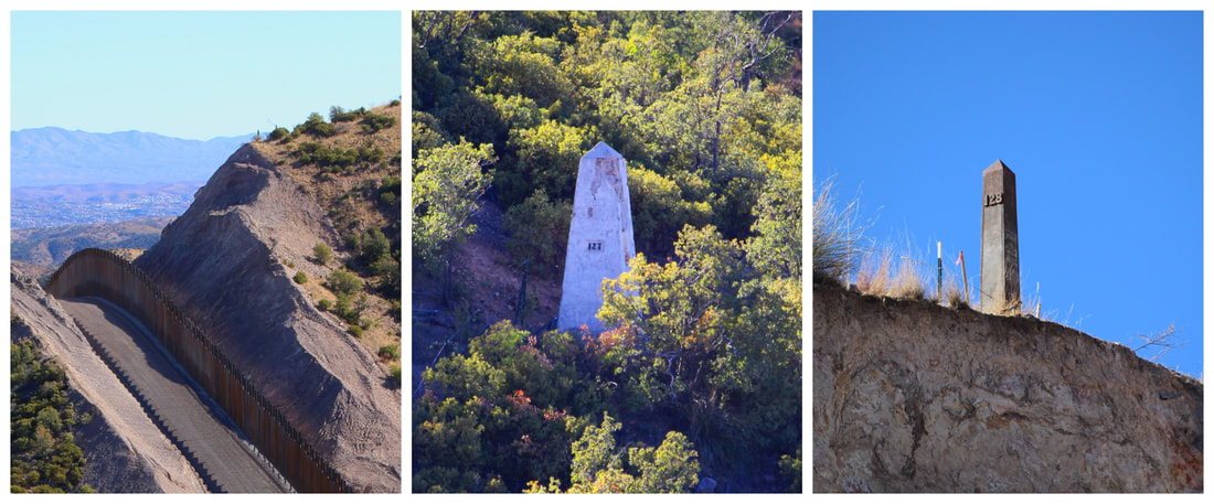
U.S.-Mexico Boundary Monuments 126, 127, and 128 (all in the wrong place)
Whether malicious or accidental, the monumental mistake marking the Arizona-Sonora boundary angle in 1855 still haunts us as border wall construction follows the 170-year-old wrong line dividing Mexico and the United States. Though on the wrong spot, boundary angle monuments 126, 127, and 128 mark a key geographic turning point in the two countries’ border. These markers are physical reminders of the imaginary line drawn on a map by politicians as the U.S. sought Mexican territory and as Mexico pushed to retain its land connection to Baja California through northwestern Sonora. As some of the oldest surviving structures in the two cities of Nogales, these endangered stone and iron monuments high in the mountains are an important part of why the border cities of Nogales exist in the first place. Arizona and Sonora developed in great part due to the unique boundary angle marked by Monument 127 in shaping the U.S.-Mexican border. Hopefully there will someday be better appreciation for borderlands history and a greater commitment by border residents to preserving our historical heritage.
About the author...

|
Carlos Francisco Parra is a doctoral candidate in history at the University of Southern California. Passionate in history and photography, he is originally from the bordertowns of Nogales, Arizona, USA, and Heroica Nogales, Sonora, México.
|
NOTES:
|
[1] Henry P. Walker and Don Bufkin, “Gadsden Treaty Proposals,” and “Gadsden Purchase 1854,” in Historical Atlas of Arizona (Norman, OK: University of Oklahoma Press, 1986): 21-22; Joseph Richard Werne, The Imaginary Line: A History of the United States and Mexican Boundary Survey, 1848-1857 (Fort Worth, TX: Texas Christian University Press, 2007): 179-189.
[2] “Gadsden Purchase Treaty,” The Avalon Project (https://avalon.law.yale.edu/19th_century/mx1853.asp). [3] Werne, Imaginary Line, 195-197. [4] William H. Emory, Report on the United States and Mexican Boundary Survey Vol. I, Part I (34th U.S. Congress, 1st Session, 1857): 138-139, 175 (http://www.americanhistory.amdigital.co.uk.libproxy2.usc.edu/Documents/Images/GLC04249/0#Chapters). According to Emory, the U.S. Boundary Commission established a temporary observatory at coordinates 31°, 21’ 00”.48 North, 110°, 51’, 01”.95 West to determine the location of longitude 111° west. Taking into account how Boundary Monument 127 was placed 4 minutes 28 seconds too west of the correct coordinates, it is likely the observatory was located along a steep hillside at coordinates 31°21'2.32"North, 110°55'31.06" West. [5] 1855 boundary monument sketches from Emory, Boundary Survey, Vol. I, 32, 118, 120. [6] Emory, Boundary Survey, Vol. I, 32, 118, 120. [7] Images of Emory and Jiménez from “William Helmsley Emory,” Aztec Club (http://www.aztecclub.com/bios/emory.htm) and Werne, Imaginary Line, 201. [8] Werne, Imaginary Line, 206-208. [9] Report of the Boundary Commission Upon the Survey and Re-Marking of the Boundary Between the United States and Mexico West of the Rio Grande, 1891 to 1896. Part I (Washington, D.C.: 55th U.S. Congress, 1898), 48. [10] Photographs of Boundary Monuments 126, 127, and 128 by Daniel Payne in Report of the Boundary Commission Upon the Survey and Re-Marking of the Boundary Between the United States and Mexico West of the Rio Grande, 1891-1896. Album (Washington, D.C.: U.S. Government Printing Office, 1899), (https://digital.library.unt.edu/ark:/67531/metadc1030/m1/129/zoom/?resolution=1.5&lat=1767&lon=750). |
[11] Mexican President Porfirio Díaz made only a half-hearted diplomatic attempt to address the boundary’s incorrect location in the later 1890s. See Joseph Richard Werne, “Redrawing the Southwestern Boundary, 1891-1896,” The Southwestern Historical Quarterly vol. 104, no. 1 (2000): 1-20. Patricio Martínez García, the PRI Senator for Chihuahua from 2012-2018, is one of the few modern-day Mexican politicians to raise questions about the issue of the erroneous Gadsden Purchase boundary when Donald Trump began promoting construction of the U.S. border wall system in 2017. “México debe reclamar 57 mil hectáreas a EU: Patricio Martínez,” Informador (May 7, 2017), (https://www.informador.mx/Mexico/Mexico-debe-reclamar-57-mil-hectareas-a-EU-Patricio-Martinez-20170506-0002.html).
[12] Arthur Schott in Emory, Boundary Survey, Vol. I, Part II, pg. 69. [13] Emory, Boundary Survey, Vol. I, 32, 120. [14] A big hat-tip to Curt Prendergast’s excellent article on Boundary Monument 127, “160 Years Later, Border Monuments Still Fascinate,” Nogales International (Jan. 5, 2015), (https://www.nogalesinternational.com/news/160-years-later-border-monuments-still-fascinate/article_62f9ebd0-9291-11e4-822c-13a2f5fb3ece.html). Before reading this excellent article I also was unaware of the important history BM 127 has – or of the erroneously marked border! [15] The Pajaritos and Atascosa Mountains to the north and the Santa Rita Mountains to the east have some of the highest concentrations of documented jaguar sightings in the U.S. Southwest. See Emil McCain and Jack Childs, “Evidence of Resident Jaguars (Panthera Onca) in the Southwestern United States and the Implications for Conservation,” Journal of Mammalogy vol. 89, no. 1 (2008): 1–10; James R. Hatten, Annalaura Averill-Murray, William van Pelt, “A Spatial Model of Potential Jaguar Habitat in Arizona,” The Journal of Wildlife Management vol. 69, no. 3 (2005): 1024–1033. [16] Genesis Lara, “Forest making way for border wall construction west of Nogales,” Nogales International (Sept. 11, 2020), (https://www.nogalesinternational.com/news/forest-making-way-for-border-wall-construction-west-of-nogales/article_eccdc664-f3c6-11ea-bf19-276d7c146669.html); Jonathan Clark and Nick Phillips, “New border wall going up in wilderness west of Nogales,” Nogales International (Nov. 28, 2020), (https://www.nogalesinternational.com/news/new-border-wall-going-up-in-wilderness-west-of-nogales/article_578d5ba8-3112-11eb-b023-af4f930b07b2.html); Curt Prendergast, “$1.28 billion wall project on Arizona border goes to firm favored by Trump,” Arizona Daily Star (May 20, 2020), (https://tucson.com/news/local/1-28-billion-wall-project-on-arizona-border-goes-to-firm-favored-by-trump/article_ad3b3de1-ccbd-5771-951c-49e09c720ec0.html). |